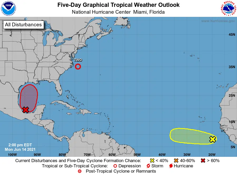
Forecasters are giving a broad area of low pressure in the Bay of Campeche a high chance of developing into at least a tropical depression over the next five days. State Climatologist Barry Keim says the disturbance is expected to stay in the southern Gulf of Mexico for the next couple of days before heading north.
“And many of the models are taking this storm to Louisiana with a landfall sometime around Sunday morning,” said Keim.
Keim says a lot could still happen with this developing storm, but it would be wise for everyone to keep an eye on this system. He says at this point, he’s not expecting this disturbance to develop into our first hurricane of the season.
“If this thing does come to Louisiana, this is not likely to be a very strong system, it could get to tropical storm strength, but most likely it could potentially be a big rain producer for Louisiana,” said Keim.
Keim says the public also needs to pay attention to the heat. Heat advisories have been posted for today across north Louisiana and southeast Louisiana as heat index values will approach 110-degrees. Keim says it’s our first taste this year of hot temperatures.
“We all have some accimiliation that needs to take place, by August will be more hardened to these kinds of weather conditions, but right now it’s bit of a shock to the system,” said Keim.


Comments