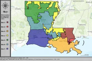
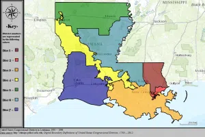
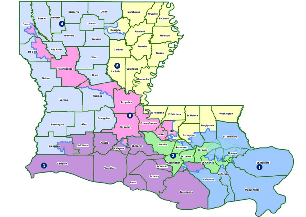
The congressional map with a second majority-Black district passed in the special session is getting pushback from some Republicans. St. Bernard Parish Representative Mike Bayham said the map that stretches the 6th congressional district from parts of East Baton Rouge Parish to parts of Caddo Parish resembles one the courts struck down in the 90s.
“If you look at the way these lines just meander in and out of communities, it’s certainly not a compact map, it’s not something that represents communities of interests. It’s more driven by demographics,” said Bayham.
Below are Louisiana Congressional Maps that were rejected in 1993-1994 (top) and in 1995-1996 (bottom)


Bayham is among a group that plans to challenge the map in court. He said this map also separates a neighborhood in his own legislative district of St. Bernard Parish.
“Not a subdivision, but a neighborhood. If you’re on one side of Plaza Drive, you’re in the 1st Congressional District but if you’re across the street you’re now in another federal district, that’s absurd,” said Bayham.
He said the other side of the street is in the 2nd Congressional District.
Bayham said the map is ducking in and out of neighborhoods in St. Bernard Parish and it’s more like an abstract painting versus a map that represents a community of interest.
“And that’s completely unacceptable. I don’t know how any Federal judge could stand by such a rendition of a map. Looks more like a Jackson Pollock painting than it does a Federal map,” said Bayham.
This is also the map favored and signed by Governor Jeff Landry.


Comments