National Hurricane Center
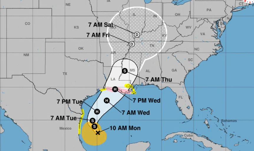
Tropical Storm Francine has formed in the South Gulf of Mexico and is eying a Louisiana landfall. National Weather Service Meteorologist Montra Lockwood says Francine is expected to intensify into a Category I hurricane by Tuesday night…
“and it’s going to be moving to the northeast toward the Southern Louisiana coast by Wednesday night.”
A Storm Surge watch has been posted for Cameron, Vermilion, St, Mary and St. Martin parishes as a ten foot storm surge is possible. Francine is also expected to produce several inches of rain across the southern half of the state and into northeast Louisiana
“We’re also looking at localized arial amounts of rainfall of 4-8 inches, but some localized amounts of up to 12 inches as well.”
Lockwood says Francine will pick up speed on Tuesday night and should push through Louisiana quickly…
“Good news, I guess, is that its going to be accelerating to the northeast pretty quickly so it should be moving out of the area by early Thursday.”

Comments