


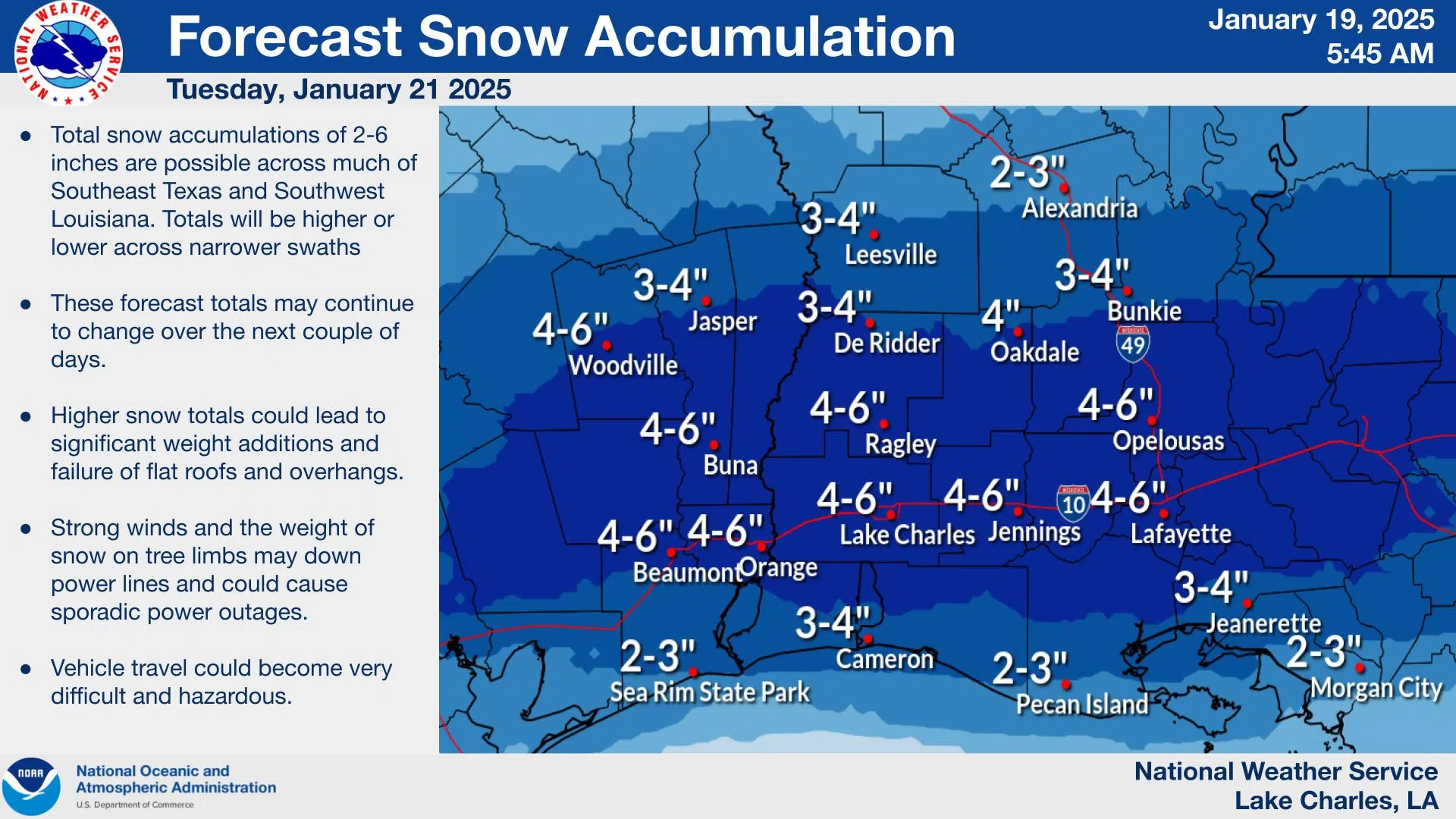
The biggest snowstorm in decades could take place in Louisiana tomorrow. The National Weather Service says four to six inches of snow could fall north of I-10 to south of Alexandria. Two to four inches could fall south of the I-10-12 corridor and one to two inches could fall between Alexandria and I-20.
NWS Meteorologist Donald Jones says temperatures Tuesday night into Wednesday will be in the teens for most of the state.
“As we get into Tuesday night into Wednesday, we are talking about single-digit wind chill values, so getting very, very cold again that’s going to be our coldest overall night, with wind gusts on top of that we are talking in some cases possible close to zero with those real feel temperatures,” Jones said.
But it’s the snow that everyone is talking about. Jones says predicted snowfall accumulation could fluctuate before Tuesday, but the current projection is four to six inches of snow along the I-10 corridor, but Alexandria, Bunkie, Houma, Morgan City, New Orleans, Hammond, and Slidell could see three inches and possibly more.
“Most of us have not seen this much snow in this area in our lifetime for those of you who spent a lifetime in this area, this may very well be the most snow that you have every seen in this area,” Jones said.
Jones says because temperatures will be below freezing for most of the day on Tuesday, freezing rain is less likely.
“We are looking at about a 20% chance of seeing some freezing rain, along with those sleet and snow accumulations, but I think the snow is going to be very much more prevalent as compared to the freezing rain,’ Jones said.


Comments