


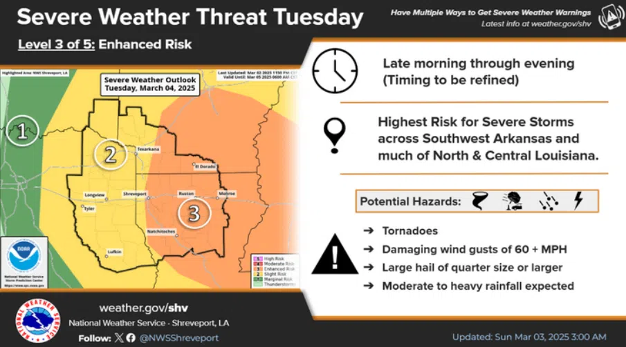
The state is forecast to have its first major potential spring weather event and unfortunately, it arrives on Fat Tuesday. Meteorologist Matt Hemingway with the National Weather Service in Shreveport says the severe weather threat begins tomorrow morning…
“Especially in the northern part of the state where we are in an enhanced risk of severe thunderstorms that can include damaging wind gusts, large hail, and even some tornadoes mixed in there as well.”
Hemmingway says most severe weather is forecast to move across North Louisiana, but could extend south into Central Louisiana.
“It does appear that threat does drops off just a little bit as you get south of I-10.”
Hemmingway says to expect sever weather to move into northwest Louisiana around 9 AM…
“And continue eastward through the remainder of the state as we move into the afternoon hours. So, really we’re looking at a window from about 9 am through sunset.”


Comments