


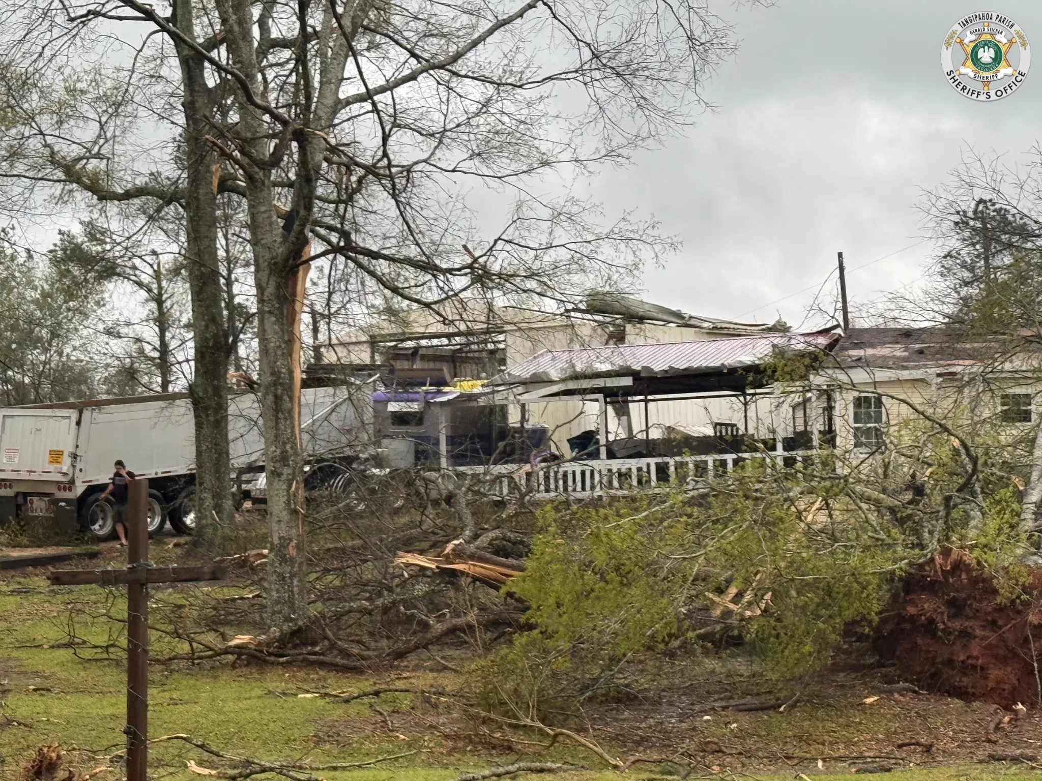
A National Weather Service (NWS) survey team confirmed that two tornadoes touched down east of Kentwood in Tangipahoa Parish on Saturday and, later moved into Pike and Walthall Counties in Mississippi. NWS Senior Forecaster Rob Frye says they were around a mile of each other.
“One track is preliminary rated an EF-3. The other is preliminary rated an EF-2, and the tracks are actually about a mile or two from one another. So, unfortunately, we had two storms that tracked over almost the identical area.”
Frye says that the ratings are subject to change as the survey continues, with details on peak winds, path lengths, and widths of both tornadoes yet to be determined. He says due to how close they were it is difficult to determine each storm’s effects especially when you track into Mississippi.
“Trying to figure that out is definitely like a thousand-piece jigsaw puzzle. Trying to figure out which tornado did what.”
So far there are reports of more than 20 homes being damaged by the two storms, but no injuries. Frye says it’s not uncommon for two twisters to follow similar paths.
“In big events like this. You’re going to have multiple supercells develop, and sometimes based on where they develop they can be in a line where the cells go down like a train track unfortunately in this case.”
Frye says updates on the storms will be updated as they can survey more of the impacts of the storms today.


Comments