


courtesy of National Hurricane Service
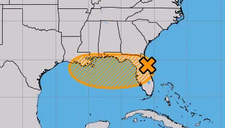
Forecasters are now urging those of you near the Gulf Coast to be weather aware for the next few days. LSU Public Health Climatologist Barry Keim says there’s a disturbance brewing in the gulf; however, it will not rise to the level of a major storm.
“It’s going to be a minor nuisance. Street flooding could possibly be the biggest issue with this storm. That’s something we’ll clearly have to watch,” Keim said.
Keim says there’s less than a 50-50 chance of a tropical cyclone forming.
“The National Hurricane Center is giving this system a 40% chance of developing into a closed circular rotation. In other words, a tropical depression,” Keim said.
Keim says while wind will not be a factor, heavy rainfall will be.
“It looks like this thing could be making a landfall in Louisiana sometime on Thursday. And then basically kind of sit south central part of the state for a good 24 to 36 hours. And it could drop a lot of rain on us,” Keim warned.
Governor Landry will be holding a news conference at GOHSEP tomorrow morning to give an update on the state’s emergency response, should it be necessary.


Comments