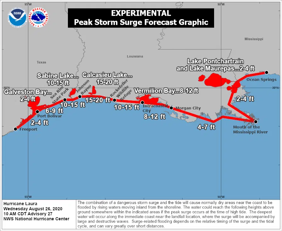
Hurricane Laura is an extremely dangerous Category Four storm as it eyes a landfall in Cameron Parish early Thursday morning. Joel Cline with the National Hurricane Center says Laura will produce a catastrophic storm surge.
“The storm surge values in the southwestern part of Louisiana and the coast is 15-20 feet and that’s just simply unsurvivable,” said Cline.
Once Laura makes landfall it will continue to head north along the Louisiana-Texas state line. Cline says the storm will produce heavy rainfall, a half a foot could fall in a short amount of time.
“That will continue all the way through the western part of Louisiana, up into central Arkansas with five to ten inches of rain, so lots of areas of flash flooding,” said Cline.
Laura’s maximum sustained winds are 125 miles per hour and the storm is expected to maintain hurricane strength as it moves over Toledo Bend Thursday morning. Benjamin Schott with the National Weather Service says hurricane-force winds will be felt in Alexandria and south of Shreveport.
“I think the damage from this will be unfortunately devastating at a level that a lot of people will not be able to recognize the areas that they live in, if these winds are realized with this forecast,” said Schott.


Comments