


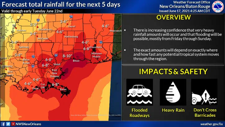
The National Weather Service has issued a flash flood watch for southeast Louisiana as six to ten inches of rain could fall between tomorrow afternoon and Sunday morning. NWS forecaster Meghan Williams says the New Orleans area is expected to see the highest rainfall totals as a result of a potential tropical storm.
“Looking at six to ten inches of rainfall possible with locally higher amounts possible as well Friday afternoon through Sunday.”
Terrebonne and Lafourche Parishes could see four to six inches. Projected rainfall totals are lower for Lake Charles and Lafayette, two to three inches. Williams says heavy rains should begin to affect portions of Louisiana on Friday.
“You get these bands so you’ll get a lot of rain in a short amount of time, then you’ll have a break and you’ll get other bands later.”
The low-pressure system has been hanging out in the Bay of Campeche this week, but it’s expected to move towards Louisiana today and a tropical depression could form tonight or tomorrow morning. Williams says once the disturbance gets better organized, they’ll have a better idea where the heaviest rain will fall.
“It’ll be much clearer for us once we actually have something that forms down there.”


Comments