


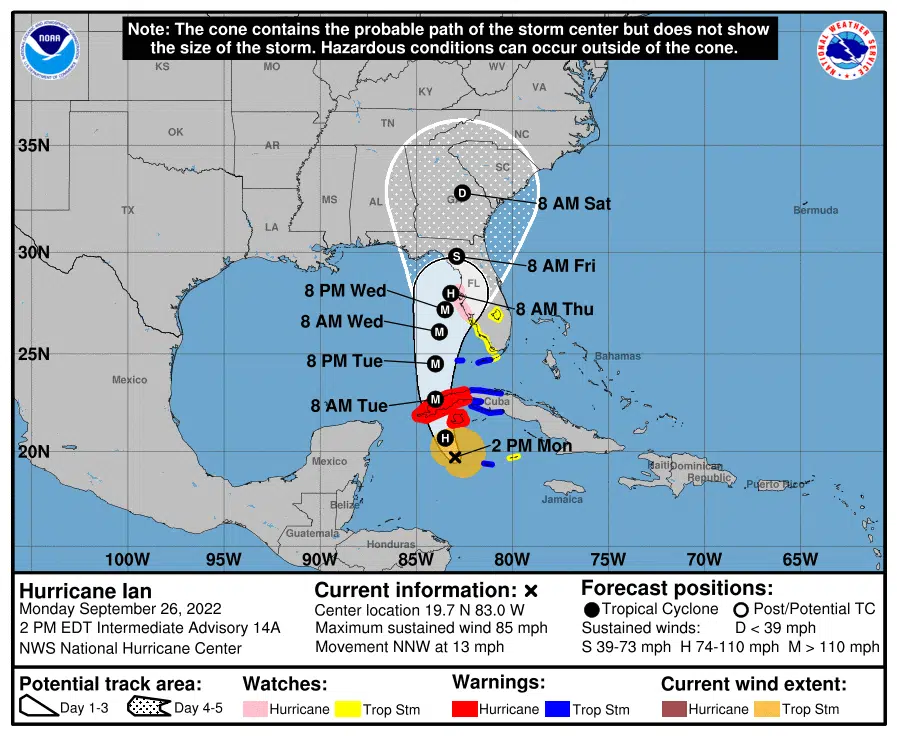
Hurricane Ian is in the Caribbean nearing Cuba and heading towards Florida as a Category 1 hurricane. Ben Schott with NOAA says its path shows some uncertainty, but not enough to concern us in Louisiana.
“The uncertainty doesn’t put us at play at all but for the folks in Florida it is hard to know whether it’s going to be Ft Myers, Tampa, Tallahassee,” Schott said.
Depending on where it hits, Ian is forecast to hit somewhere in Florida as early as Wednesday night as a major hurricane. Schott says one of the biggest concerns for Florida is possible storm surges in Tampa Bay. The current forecast has the eye hitting right where the Florida peninsula meets the panhandle.
“Once it makes landfall somewhere in Florida there will be a slight nudge to the west just because of the way the upper pattern is going to steer this system,” Schott added.
Schott says the biggest impact for most of Louisiana should be winds of up to 25 MPH for a couple of days.
“If you were a bar pilot and you were all the way down on the mouth of the Mississippi you may see tropical storm conditions. The storm’s gonna be that large,” Schott sais.
Louisiana will have great weather this week as it will be dry with high temperatures in the low to mid-80s after a cold front moves through the state today


Comments