


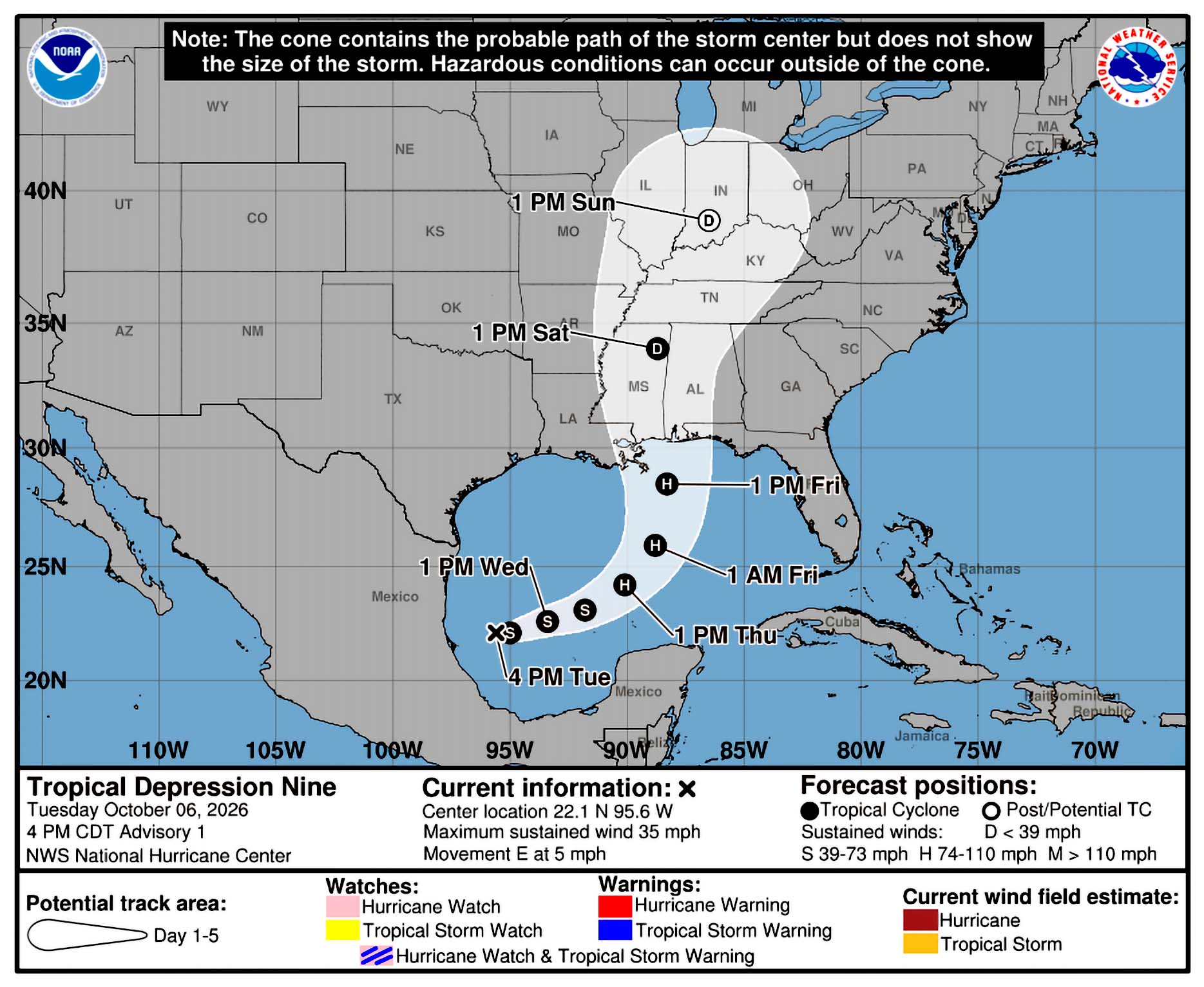
An official forecast track from the National Hurricane Center shows a Category 2 Hurricane making landfall near the Mississippi-Alabama border on Friday night or Saturday morning. LSU Health Climatologist Barry Keim says southeast Louisiana should pay close attention to this storm, because that part of the state is in the cone of uncertainty.
“A little tweak with the storm track is going to put you right in the crosshairs of this particular storm, so don’t read too much on the exact point of landfall at this particular time; look more at the cone,” Keim explained.
Keim says the system will bring areas of heavy rainfall to the central U.S. Gulf coast on Friday and into the weekend.
“We could be looking at rain totals 3-6 inches, with isolated areas quite a bit higher, maybe even up to 10 inches,” Keim said.
According to the National Hurricane Center, there is slight risk of flash flooding for the next five days over the eastern half of the state.
Keim says there is a risk for dangerous wind and storm surge impacts for the northern Gulf Coast.
“Especially in southeastern Louisiana and near Lake Ponchartrain, with those southeasterly and easterly winds as that storm approaches,” Keim noted.





Comments