


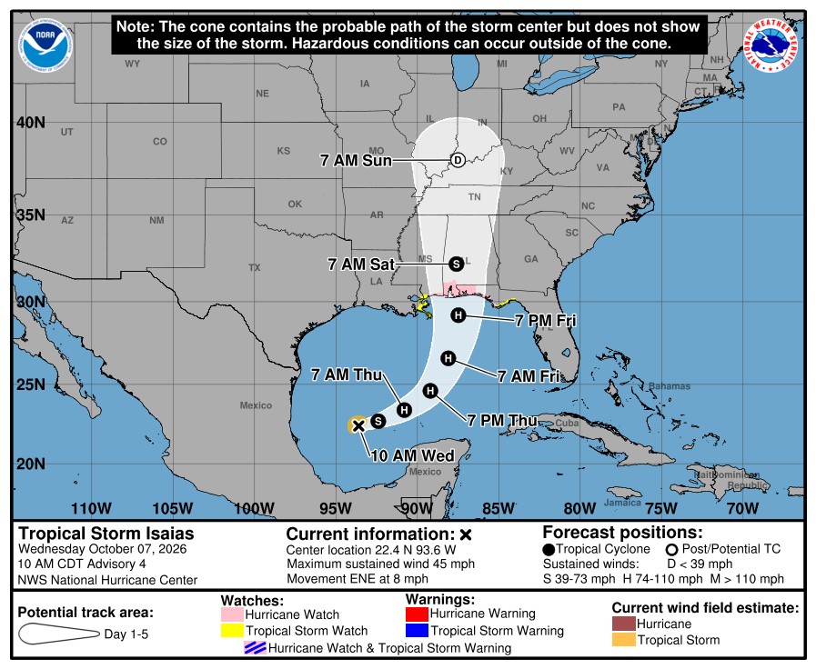
Tropical Storm Isaias does not look like a problem for Louisiana. The National Hurricane Center’s official forecast track continues to shift father to the east. The latest update has the storm making landfall near the Alabama-Florida state line. National Weather Service Meteorologist Phil Grigsby says the steering currents are pushing the storm away from Louisiana.
“Pretty strong trough area of low pressure, basically like in upper levels; it’s going to be like where the planes fly, basically. It’s going to be coming in from Texas. That’s also going to help kind of kick it off to the east,” Grigsby said.
Grigsby says Louisiana could still see some effects. He says a storm surge watch and tropical storm watch has been issued for Plaquemines, St. Bernard, Orleans and the southeastern corner of St. Tammany parishes.
“Anybody who’s got camps, anybody that lives out there, involved with the fishing industry or anything like that; be prepared for some higher water and some gusty winds, especially Friday afternoon into Friday night,” Grigsby noted.
Grigsby says Louisiana will see less than an inch of rain from the storm that is expected to make landfall either late Friday night or early Saturday morning.
“Once you get towards, say, Hammond and Baton Rouge, even parts of New Orleans; it’s not going to be that bad of a day. It’s going to be a little breezy, a little bit cloudy, but we’re not really expecting much in the rain, even,” Grigsby explained.
Isaias is expected to develop into a hurricane, possibly a strong Category two storm before weaking to a Category one storm before landfall.





Comments